
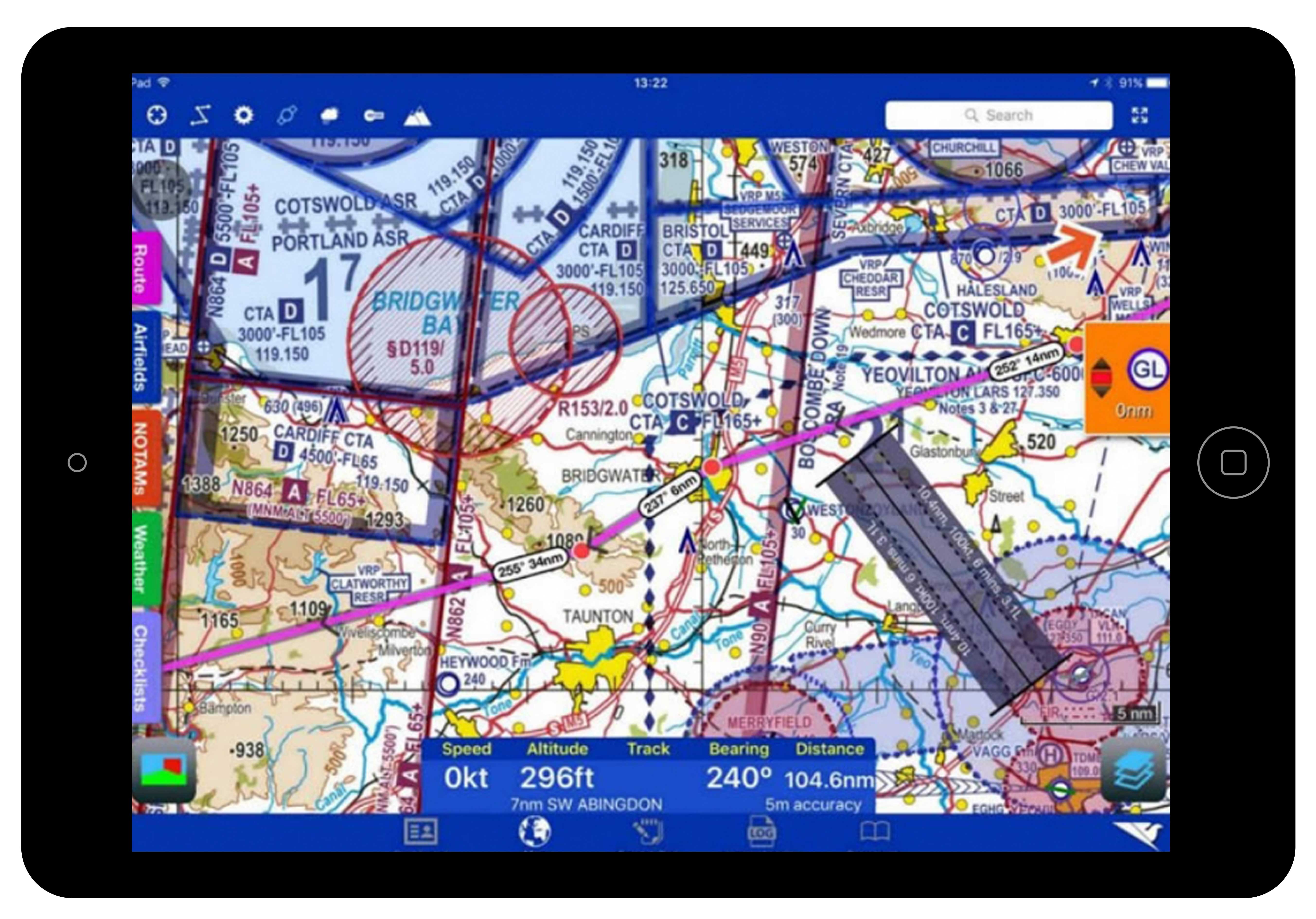
Handy NOTAM and weather overlays quickly show anything in your path and with daily updates you know you’ll be using the latest data. Don’t want to go around? Well go over! Using the side profile you can see which airspace and NOTAMs can be avoided by simply going higher.
When you are happy with your route, run the Route Briefing to calculate a range of flight parameters including: time on route, fuel required, distance and ground speed. This can be saved or printed, but also includes an interactive view for when you get airborne.
Going places? Easily file your flight plan and GAR from RunwayHD at no extra cost, it’s all included in your subscription
Buy Now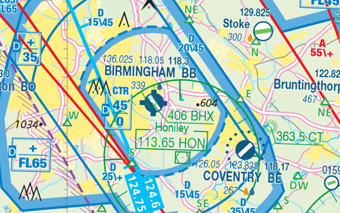 Airspace
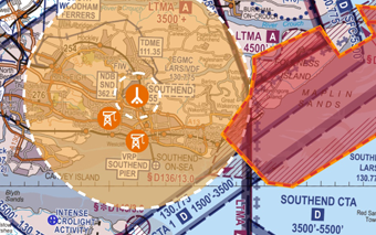
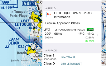
Clearly defined airspace shown over any map type. Plan on ICAO, Google or Street level mapping.
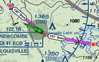 Routes
Easily drop and drag waypoints to form your route. Save, load and send to a friend.
 NOTAMs
Daily NOTAM updates ensure you’re aware of what’s going on and can plan your flight accordingly, anywhere in the world.
 Weather
METAR, TAF and winds aloft for the globe ensure you have the latest weather data to plan with.
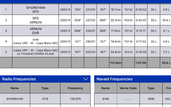 Route Briefing
Calculate route times and fuel required. Refer to it in flight or print before you go.
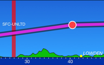 Side Profile
Use the side profile to check clearance from high ground and airspace.